| The author(s) of this timeline are not accepting major edits to this work. The only ones authorized to edit this page are . However, exceptional edits include spelling, grammar and cohesion fixes. |
It is a nation made from a maine island about of about the same size of Vancouver Island, 3 lesser islands, 7 islets, 3 sea stacks and 8 skerrys; that lie in a region both 1,145 Km west and 45 Km south of Vancouver city center.
It is a democratic former Prussian come German Imperial (1825-1912) colony.
Motto | |||||||
| Anthem: | "Die Demokratische Republik Deutsche Inseln wird gewinnen" | ||||||
| Capital: | Neue Brandenburg. | ||||||
| Largest city: | Neue Kiel. | ||||||
| Other cities: | Neue Hanover, Neue Frankfurt, Neue Potsdam, Neue Swinefort, Santa Maria, Nova Lisboa, Neue Berlin, Neue Wien, Neue Tallinn, Nordspitze and Ulrich's Bucht. | ||||||
| Language: official: |
Standard German and Austro-Bavarian German. | ||||||
| others: | Magyar Hungarian, Sorbian, Czech, Portuguese, Castilian Spanish, British English, Canadian English and American English. | ||||||
| Religion: main: |
45% Catholic | ||||||
| others: | 44% Protestant and 11% irreligious. | ||||||
| Ethnic group: | Overwhelmingly Germans and Austrians; with some Czechs, Sorbs, Spanish, Hungarians, Portuguese and mixed origin people. | ||||||
| Demonym: | Insulaner (Islander). | ||||||
| Type of government: | Democratic Presidential Republic. | ||||||
| President.: | Kurt Strauss (CDU) | ||||||
| Chancellor.: | Hans Luukanen (CDU) | ||||||
| Population: | 1,247,656. | ||||||
| Established: | 1832 | ||||||
| Independence: | from German Empire | ||||||
| declared: | 1912 | ||||||
| recognized: | 1912 | ||||||
| Annexation: | to N/A | ||||||
| date: | N/A | ||||||
| Currency: | Island Mark (6 IM= 1 US$ in 2012) | ||||||
| Time zone: | Alaskan | ||||||
| summer: | Yes | ||||||
| Internet TLD: | GI | ||||||
| Calling code: | 098980 | ||||||
| Organizations: | NAFTA, UN, UNESCO, IMF, PTO and NATO. | ||||||

Geography[]
It is a nation made from a roughly oblong maine island about of about the same size of Vancouver Island, 3 lesser islands, 5 islets, 3 sea stacks and 8 skerrys; that lie in a region both 1,145 Km west and 45 Km south of Vancouver city center.
Deutsch-Insel (German Island) is the principal island and has an area of 29,500 km2. It is in general physically similar to Vancouver Island, but a very much flatter in vertical elivation.
1.5 km to it's east is the 245 acres2 Grüne Insel (Green Island) wich is akin to Soay. 0.25km firther east is the 20 ha2 (49 acres) Harriett Insel (Harriett Isle) which is akin to Shag Rocks.
10 km to the west of the main island is the 109 hectares2 Kiser Insel (Kiser Island), which is comparibl to North Rona and 1 km further west is Kleine Insel (Small Island) which is the simlar to Sula Sgeir 15 ha. 1.5 km south of Kiser Insel is the 2.9 ha2 sea stack Felseninsel (Rock Island), whick is of similar values to Sule Stack.
100ft south of Deutsches-Insel is the 450-foot tall Kleine Meer Stapel (Small Sea Stack). 1.25 km to its south is the is the 44 acres2 Insel Marien (Mary's Island), which is comparible to Jethou. 1km south of it is the hilly and roughly cricular Südinsel (Southern Island), which has an area of 3,585 km2 and is similar to the main island of the Faroe Islands, but bigger in area. Another 500ft southward is the 1 acher2 Wertlos Insel (Worthes Island) sea stack that resembles Stac Lee. 0.25km to the south west of Wertlos Insel is the 15ha Henrietta Insel (Henrietta Island) which is akin to Craiglethy.
1.25 Km north east is Die Möwe Insel (The Seagull Island), which is 8,445 sq ft2 in area and is akin to Rockal, and 1.5km north west is the Die Sechs Scharfen Felsen (The Six Sharp Rocks), each of which resembles six 26.5 m2, 3.5 m tall verticly sharpened version of Skerryvore. The total area of the nation's landmass is about 105% that of Canada's Vancouver Island.
The highest points are is the 1,500-foot Mount Ulrich and 1,200ft Mount Magda on Deutsch-Insel, and the 1,1000ft Beinn na h-Iolaire (hill of the eagle) on Südinsel.
Kiser Insel and Insel Marien islands are both the sites of an automatic light beacon which is remotely monitored by the Deutsch-Insel Lighthouse Board.
Wildlife[]


The papermill on the River Ulrich near New Hanover.
The abundant wildlife includes grasses, heathers, thick gorse, thrift (Armeria maritima), marsh marigold (Caltha palustris), western hemlock, western red cedar, Pacific Silver Fir, yellow cedar, Douglas-fir, grand fir, Sitka spruce, and western white pine. It is also characterised by bigleaf maple, red alder, sword fern, and red huckleberry. are the main plant on the islands.
The main wildlife found on the islands other than farm animals are Pacific gulls, kelp gulls, silver gulls, feral rabbits, rats, bald eagles, salmon, halibut, whale, stoat, Insular Grey Squirrels, voles and wandering albatrosses.
Shellfish, clams lobsters, prawns, jellyfish and sea urchins live on coastal rocks. Trout, salmon, and rainbow trout live in the rivers and along the coastline.
Fish in the River Ulrich are slightly smaller than average due to
Geology[]
The islands are mostly made up of made of a type of peralkaline granite that is relatively rich in sodium and potassium. Within this granite are darker bands richer in the alkali pyroxene mineral aegirine and the alkali amphibole mineral riebeckite.
Felseninsel, Kleine Insel and Kiser Insel formed of Lewisian gneiss, formed in the Precambrian eon, these rocks being amongst the most ancient rocks in North America. A further nautical hazard to shipping is a magnetic anomaly in the area.
The region around Ulrich's Bay is formed of Lewisian gneiss. The hard gneiss rock of which the islands are made splits into long pieces, which are excellent for building with, but the hard rough boulders and sharp rocks make for difficult and dangerous hill walking. In other places on Deutsche Insel (German Island) patches of Torridonian sandstone and shale, grey-banded Archaean Lewisian gneiss and granulite with layers of gabbro, peridotite and anorthosite. There are also a few Jurassic oil shales and sandstones occasionally interspersed with limestone and the related ironstone beds contain low grade oolitic siderite and chamosite ores.
Southern Island is largely made up of several giant slices of tiered basalt, that were tilted 45% to one side in an ancient seismic upheaval.
Kleine Meer Stapel is uniquely a red sandstone stack, perched on a plinth of basalt rock. It is comparible to the Old Man of Hoy.
A shallow icecap was on top of most of German Island in the Pleistocene era.
Climate[]
The climate ranges from mild oceanic in the south to subpolar oceanic in the north. It is very similar to the climate of the West Coast of Scotland in terms of both the average annual temperatures and precipitation.
The islands' temperatures are moderate all year round. Rainfall is generally heavy, especially in the autumn months, when in the most exposed south western areas near Ulrich's Bay and the far north of German Island see average daily rainfalls as high as 317 millimetres (12.5 in) and the annual rainfalls are among the highest in the world outside the tropics.
The inevitable rain shadow effect of German Island's mountains, creates wide variation in the precipitation. The west coast is considerably wetter than the east coast due to the precipitation falling on the central mountains as snow. In the relatively shielded areas around New Vienna, Santa Maria and New Berlin have annual rainfall averages ranging from 1,207 millimetres (47 in) to 1,405 millimetres (55 in).
Snowfall is generally moderate and comes between December and January, averaging from 10 centimetres (3.9 in) in across most of the Islands to 70 centimetres (28 in) in the far north of German Island near North Bay and North Point, though in the mountainous parts of German Island it averages around 105 centimetres (39 in) and is only 1.25 centimetres on Green Island.
Precipitation is frequent, occurring on around 2/3 of the days of the year, even in relatively shielded areas.
Hurricane Twelve/the 1975 Pacific Northwest Hurricane battered the south and east of the islands on on September 4th. The highest 1-minute sustained winds was 65 mph (100 km/h).
Hurricane Guillermo (1997) battered the north and east of the islands on August 17th. The highest 1-minute sustained winds was 75 mph (120 km/h).
The amount of direct sunlight is low, averaging around 4 to 5 hours per day.
History[]
Pre-1600[]
The small number of Nivkh, who are believed to be the original inhabitants of the region deriving from a proposed singel group of Neolithic people migrating from the Transbaikal region and then bother Sakhalin Oblast and the Kuril Islands by canoe during the Late Pleistocene era.
The remains of 25 ~11,000-15,000 year old Chukchi people 5 Koryaks and 5 Itelmens in a cave near North Point. Charcol, ash, burnt stown, hand tools, a shoe, a primitive wood carving of the raven spirit Kutkh and remnants of eaten salmon, halibut and whales were also found there. The site was in use for about ~1,000 years.
All that is known for certain is that oral tradition holds that approximately as far back as ~13,000 years ago, a group of people inhabited the islands and developed a peaceful and complex culture made rich by the abundance of the land and sea. The people were ultimatly an off shoot of the Haida People.
German Island and Southern Island were first notably occupied around 2,000 to 2,500 years ago by coastal people characterized by artifacts decorated in the Okvik (Oogfik) style. The sites were similar to the archaeological sites found on the Punuk Islands, off the eastern end of St. Lawrence Island, at Kukulik, near Savoonga and on the hill slopes above Gambell have evidence of the Okivik occupation. The Okvik decorative style is zoomorphic and elaborate, executed in a sometimes crude engraving technique, with greater variation than the Old Bering Sea and Punuk styles. The people connected to this were an off shoot of the Alutiiq, Aleut and Inuit.
All 4 tribes existed in near continuous harmony apart from a short and minor war over fishing rights in ~1250 after 3 continuous years of poor fishing off the islands' coasts.
However, long-distance Polynesian voyaging between Hawaiʻi and German Island and South Island occered between about 1250 CE and 1450 CE, which lead to a breif war and the founding of thire tribe in circa ~1400, according to the Polynesian oral traditions by the time of the first Europeans made contact. The agriculturally more advanced Polynesian colonists brought along with them clothing, plants and livestock and established settlements along the coasts and larger valleys.
1600-1822[]
Several of the out lying islands were spotted by Spanish and Portuguese navigators in the 17th century. French, British, Russian, Prussian and Dutch sailors also sighted some of the islands in the early 18th century.
Portugal and Spain both founded their small colony on the German Island in 1750, South Island in 1751 and Green Island in 1790.
The island archipelago was first visited by Europeans in 1774 by Juan Pérez on his way to Langara Island, and in 1778 by James Cook on his way to the Queen Charlotte Islands. Both claimed all the islands for their home nations.
British sailors also visited Southern Island between 1790 and 1795, but did not informally claim the island until 1795. They also named the island's main mountain Beinn na h-Iolaire, the main river- the River Kennet, and main bay Hove Bay.
A smallpox plague killed 60% of the native population in 1794 and 1795.
An exsplorer from Electorate of Brunswick-Lüneburg exsplored Southern Island, Seagull Island and Worthless Island in 1806. He later also informally claimed them for Hanover.
Individual wealthy merchants from Duchy of Brunswick the Free City of Lübeck Free City of Lübeck Breman with Bremenhaven started setting up minor Insular Grey Squirrel fir trading businesses on German Island and Southern Island in 1810
A French explorer charted both Green and Seagull Island and then formally claimed them as French 1812.
A small group of passing merchant sailors from Grand Duchy of Oldenburg landed on South Island and then informaly claimed it for Oldenburg in 1814. The Grand Duke made the claim formal in 1818.
1823-1899[]


Portuguese settlers from the 1880.


.jpg)
New Brandenburg in 1895.
Both the Margraviate of Brandenburg and the Duchy of Prussia set up minor colonies on German Island (the main island) in 1823 and 1824 respectivley.
A rebellion by the Spanish and Portuguese settlers at Santa Maria was quickly put down in 1830 at the cost of 7 Prussian soldiers', 8 Spanish settlers' and 9 Portuguese settlers' lives.
The colonies began to slowly grew after 1835, when everyone renounced their rival claims and let Prussia have full rule over the island.
The fur trade started up in 1862 and the lucrative whaling industry started up in 1875. Both would last to 1910. Ulrich's Bay and North Point would gain greatly from it.
An influx of poor German and Danish farming settlers came from the Province of Schleswig-Holstein in the 1870s and 1880s.
The American navy and the Prussian navy did battle for the Island on March 1st 1878. The Prussian's ironclad almost suck the American ironclad. 120, Prussians, 17 Islanders and 125 Americans died.
The logging industry was the maine industry between 1880 and 1920 and supported most jobs in Santa Maria, Ulrich's Bay and New Hanover.
A major influx of Estonians, Swedes, Norwegians, Finns and Swiss occered in the 1880's
1900-1913[]


Sorbian settlers from 1900.
The paper and fishing industries started in 1905. This started the development of New Kiel, New Brandenburg, New Lisbon, New Tallinn, New Vienna, New Hanover, Santa Maria and New Berlin.
1914-1945[]


Children at a state run activities center in 1940.
Militant nationalism and national socialism never really took off and went into sharp decline in favor of social democracy and socialism in the, late 1930's.
They were neutral in WW1 and joined the Allies on December 1st in 1943.
1945-1969[]


.jpg)
Deutsche Inseln sent 25 troopers to serve in the Korean War.


.jpg)
A nursery school in 1958.
Deutsche Inseln sent 25 troopers to serve in the Korean War from 25 June 1950 to 27 July 1953, in which 1 of them died.
The islands' paper and fishing industries developed quickly between 1962 and 1965, with new developments occurring at Hove Bay and New Potsdam.
Low level steel production and iron mining started around New Potsdam in 1968.
1970-1989[]
Balun twisted pair to coaxial transformers, trigtransformer, mini circuit board potted transformers and electric fence insulators fist started to be made in New Kiel, New Brandenburg, New Lisbon, New Tallinn, Santa Maria and New Hanover in 1972.
Hurricane Twelve/the 1975 Pacific Northwest Hurricane battered the south and east of the islands on on September 4th. The highest 1-minute sustained winds was 65 mph (100 km/h).
Mains power to appliance usage voltage transformers started to be made in New Kiel, New Brandenburg and New Tallinn as the electronics industry expanded between 1989 and 1990.
1990-1999[]
The New Potsdam steel mill and Iron mine closed in 1990 and were dismantled in 1991.
The chemical works at New Berlin opened in 1992.
The nation joined NATO and the UN in 1995.
Hurricane Guillermo (1997) battered the north and east of the islands on August 17th. The highest 1-minute sustained winds was 75 mph (120 km/h).
Present Day[]
The joined NAFTA in 2002 and the PTO in 2003.
Government and politics[]
The president is Kurt Strauss of the CDU.
His deputy is Chancellor Hans Luukanen of the CDU.
Economy[]
")
")
_(8658910388).jpg "Fra Fajansefabrikken i Sarreguemines (ca. 1910) (8658910388).jpg (3.79 MB)")
")
")
")
Public utilities[]
")
")
Agriculture[]


A tractor on a Hove Bay farm.
Industry[]
")
")
.jpg "Toulouse - Île du Ramier - 20101207 (2).jpg (4.43 MB)")
")
Hi-tech[]
")
")
")
")
")
")
Tourism[]
Tourism has become a more prominent part of the economy in recent years, especially for fishing and tour guides, cycling, camping, and adventure tourism.
Retail[]
Banking[]
Telecommunications[]
Transport[]


2 battery powered industrial locos carrying rubble at New Potsdam municipal tip.
Health care[]
Education[]
Telecommunications[]
Demographics[]

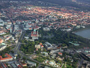
Ulrich's Bay.
2010 ethnic survey-
- Germans- 550,000
- Austrians- 525,000
- Mixed ancestry-125,000
- Hungarians- 17,555
- Sorbs- 16,859
- Portugese- 11,378
- Spanish- 5,895
- Bohemians- 5,348
- Moravians- 4,338
- Silesians- 2,275
- Kashubians- 1,273
- French- 1,558
- Poles- 1,149
- Slovaks- 548
- French- 228
- Dutch- 227
- Finnish- 226
- Swedish- 225
- Belgian- 158
- Polynesian-156
- English- 154
- Norwegen- 88
- Basques- 87
- Estonian- 86
- Anglo-Canadian- 68
- Dansh- 66
- Swiss-65
- Haida- 58
- Alutiiq- 56
- Aleut- 54
- Inuit- 53
- Nivkh- 52
Culture[]
Sport[]
Media[]
Food[]
The Dart Container Corporation of Mason, Michigan, has regularly supplied them with polystyrene/Styrofoam cups since 2008.
Festivals[]
Military[]
2,000 volunteers and 250 conscripts.
The capital's air base 5 fast interceptor jets, 6 standard fighter jets, 3 cargo plains, 1 troop plain, 3 light bombers, 2 reconnaissance jets, 4 utility helicopters and 3 attack helicopters.
5 search and rescue helicopters, a maritime patrol aircraft, a in-flight refueling jet and 2 fighter jets from a base 2 miles south of Northpoint, 1 mine sweeper, 1 mine layer, 1 patrol boat and a single utility helicopter operate from Hove Bay's navel base.
The capital's army base has only 8 M113 armored personnel carriers, 3 tractors, 5 motorbikes, 3 jeeps and 6 trucks.
The airstrip in the centrally placed mountain town of Neue Inniabruck also has an additional cargo helicopter and ground attack aircraft.
Politics[]
Law and order[]
Death Penalty[]
Images[]
")
")
")
")
")
.jpg "Spreewald Impressionen - Flickr - tm-md (160).jpg (869 KB)")
")
")
")
")
")
")